The National Weather Service has issued multiple tornado warnings and severe thunderstorm warnings overnight into early Friday across parts of the Midwest, Mid-Atlantic, Southeast, and Central Plains as a cold front advances.
Radar indicated rotation prompted tornado warnings earlier for counties including Reynolds, Butler, Carter, and Wayne in Missouri, Meeker County in Minnesota, Mecklenburg County in Virginia, and portions of southeastern Maryland. Severe thunderstorm warnings remain active or recently expired in areas such as Charlotte, Matthews, and Indian Trail in North Carolina, Summerville and surrounding communities in Georgia, and Colby, Hoxie, and Oakley in Kansas, where golf ball sized hail has been reported.
The Storm Prediction Center’s Day 1 Convective Outlook, valid through 1200Z Friday, places a slight risk of severe thunderstorms from portions of the Upper Midwest into the Central Plains and from the Southeast and Mid-Atlantic into the southern Appalachians. Isolated to scattered supercells developed ahead of a cold front and surface trough stretching from northern Minnesota and the eastern Dakotas into Nebraska. These storms are capable of producing large hail, with diameters of 2 to 3 inches possible in eastern South Dakota and Nebraska, along with severe wind gusts and an isolated tornado.
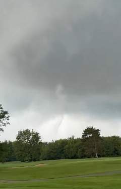
In the Mid-Atlantic, a shortwave trough and eastward surging front supported a mix of supercells and line segments. Damaging wind gusts and brief tornadoes remained possible before the system moved offshore. Farther south, clusters of storms in a moist air mass across parts of the Tennessee Valley, northern Alabama, and the Carolinas carried a risk of damaging gusts. Flash flood warnings have also been issued in locations such as Walker County, Georgia, and Philadelphia County, Pennsylvania, due to heavy rainfall.
For later Friday, the Storm Prediction Center maintains a slight risk across parts of the Central Plains. Scattered storms capable of damaging hail greater than 2 inches in diameter and severe wind gusts are expected late afternoon and evening over central and eastern Nebraska into adjacent areas, with some potential extending into northern Kansas and possibly northern Oklahoma overnight. Scattered storms with severe wind or hail remain possible in portions of the Midwest and Southeast.
Extreme heat warnings and heat advisories continue across much of the South and are building into the Southwest under a strengthening upper ridge, with high temperatures and limited overnight relief in those regions.